- Home Page /
- Electronics /
- GPS, Finders & Accessories /
- Sports & Handheld GPS /
- Handheld GPS Units /
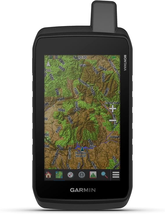
- Garmin Montana 710, Rugged GPS Handheld Navig...
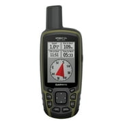
Garmin Montana 710, Rugged GPS Handheld Navigator with Large 5-inch Glove-Friendly Touchscreen, Satellite Imagery and Maps for Routing on Roads and
€ 609
Price Details
Excluding Shipping & Custom charges ( Shipping and custom charges will be calculated on checkout )
*All items will import from US
QTY:
Ubuy works hard to protect your security and privacy. Our advanced payment security system ensures confidentiality by encrypting your information during transmission using AES (Advanced Encryption Standards) and SSL (Secure Socket Layer) protocols. Your payment details are 100% secure as we do not share your payment details with third party sellers.
Stay on track with the rugged Montana® 710 handheld GPS navigator, built to guide you through all kinds of adventures.
Fast
Shipping
Free
Return*
Secure Packaging
100% Original Products
PCI DSS Compliance
ISO 27001 Certified

What Stands Out
Product Details
| Item Weight | 0.8 lbs (360 grams) |
Who Should Buy?
-
Outdoor Enthusiasts
Perfect for hikers, bikers, and campers who need reliable navigation in remote areas with tough terrains.
-
Route Planners
Ideal for users planning routes on both roads and trails, providing detailed maps and imagery for better navigation.
-
Work in Tough Environments
Designed for professionals like surveyors or construction workers needing robust navigation tools in rugged conditions.
-
Casual Users
Not suitable for those needing simple navigation, as it may have too many features for basic use.
-
Budget Seekers
Individuals looking for cost-effective solutions may find its price tag relatively high compared to simpler GPS devices.
-
Non-Outdoor Activities
Unsuitable for users primarily interested in urban navigation or standard driving, lacking specific city-focused features.
Product Description
Garmin Montana 710, Rugged GPS Handheld Navigator with Large 5-inch Glove-Friendly Touchscreen, Satellite Imagery and Maps for Routing on Roads and Trails
Customer Questions & Answers
-
Question:
What makes the Garmin Montana 760i unique compared to other GPS handheld navigators?
Answer: The Garmin Montana 760i stands out due to its rugged design and advanced inReach technology, which enables users to send SOS messages and two-way texts even in remote areas without cell coverage. Its 5-inch touchscreen provides a clear view of maps and navigation data, crucial for outdoor activities such as hiking or camping. This device is ideal for adventurers who often find themselves in uncharted territories where communication with loved ones or emergency services is vital. -
Question:
Is the Garmin Montana 760i waterproof and durable?
Answer: Yes, the Garmin Montana 760i is built to withstand the elements, featuring a waterproof design that meets IPX7 standards. This means it can handle being submerged in water up to 1 meter for 30 minutes without damage. Its rugged exterior is perfect for outdoor enthusiasts who engage in activities like mountaineering or kayaking, where exposure to harsh conditions is unavoidable. Its durability ensures that it can withstand drops, bumps, and other impacts. -
Question:
What types of maps are available on the Garmin Montana 760i?
Answer: The Garmin Montana 760i supports various types of maps, including topographic maps, road maps, and satellite imagery. Users can add different map layers depending on their needs, whether for hiking, trail riding, or driving. This flexibility is invaluable for outdoor adventures, allowing users to choose the most relevant maps for their activities, ensuring they are well-prepared and informed about their surroundings. -
Question:
Can I share my location with others using the Garmin Montana 760i?
Answer: Absolutely! The Garmin Montana 760i allows users to share their location with friends and family through the inReach technology. Using a satellite network, you can send your coordinates even when outside of cellular coverage. This feature enhances safety during remote expeditions and provides peace of mind for those concerned about your whereabouts, making it an excellent choice for solo travelers or groups heading into the wild. -
Question:
How long does the battery of the Garmin Montana 760i last?
Answer: The Garmin Montana 760i has a long-lasting rechargeable battery that can provide up to 18 hours of operation in GPS mode on a single charge. In addition, depending on usage patterns and settings, the battery life can extend up to several days when using the tracking function in power-saving modes. This makes it an ideal companion for extended outdoor adventures where accessing electrical outlets is not an option, ensuring you stay on track without worrying about battery life. -
Question:
What are the advantages of the built-in inReach technology in the Garmin Montana 760i?
Answer: The built-in inReach technology in the Garmin Montana 760i enables reliable satellite communication, allowing users to send and receive messages globally, even in areas without cellular service. This feature is crucial for safety, as it provides a direct line to emergency services if needed. Additionally, users can share their location and status with designated contacts, enhancing communication during outdoor trips. This functionality is invaluable for activities like long-distance hiking, where staying connected can be critical. -
Question:
What can I expect from the touchscreen of the Garmin Montana 760i?
Answer: The Garmin Montana 760i features a responsive 5-inch touchscreen that is both easy to read and interact with, even in bright sunlight. This high-resolution display shows detailed maps, navigation data, and photos captured by the built-in 8MP camera. The touchscreen design allows for intuitive pinch to zoom and swipe gestures, making it user-friendly for on-the-go navigation and ideal for quick adjustments during outdoor activities, creating a seamless user experience. -
Question:
Does the Garmin Montana 760i come with preloaded maps?
Answer: Yes, the Garmin Montana 760i comes with preloaded topographic maps that include detailed terrain information. Additionally, for many regions, you may find road maps and essential points of interest. This variety helps ensure that you have the necessary navigation tools at your fingertips for both off-road adventures and urban exploration, providing immediate access to important geographical data without the need for additional downloads. -
Question:
Can I track my hiking routes with the Garmin Montana 760i?
Answer: Yes, tracking hiking routes is one of the key features of the Garmin Montana 760i. This device allows users to log their trails and navigate previously traveled paths with ease. You can save and view waypoints, allowing for better planning on future expeditions. This makes it a favorite among hikers and outdoor enthusiasts who want to explore new trails while keeping a record of their adventures for future reference and navigational assistance. -
Question:
Where can I buy the Garmin Montana 760i in Malta?
Answer: You can purchase the Garmin Montana 760i from Ubuy, a reliable online retailer that offers an extensive selection of Garmin products. Ubuy provides various options and ensures you receive quality service. With their user-friendly platform, finding and buying the Montana 760i becomes a seamless experience tailored to meet your needs.
Garmin Handheld GPS Units Editorial Review
Customer Reviews & Ratings
-
5 Star
100%
-
4 Star
0%
-
3 Star
0%
-
2 Star
0%
-
1 Star
0%
Review this product
Share your thoughts with other customers
Platform Trust & Buyer Confidence
“The product received very good packaging & safe…Thank You”
“Accurate delivery timing given”
“Not madly expensive like I thought, and much quicker than promised.”
“Never dealt with Ubuy before, but everything worked out great. Seamless cross border purchasing and shipping. Thanks!”
“The process was smooth, with clear communication and timelines. This was my 1st purchase and I am really impressed. I will definitely be coming back.”
Product Price History
Important information
- Limitations : For products shipped internationally, please note that any manufacturer warranty may not be valid; manufacturer service options may not be available; product manuals, instructions, and safety warnings may not be in destination country languages; the products (and accompanying materials) may not be designed in accordance with destination country standards, specifications, and labeling requirements; and the products may not conform to destination country voltage and other electrical standards (requiring use of an adapter or converter if appropriate). The recipient is responsible for assuring that the product can be lawfully imported to the destination country. When ordering from Ubuy or its affiliates, the recipient is the importer of record and must comply with all laws and regulations of the destination country.
- Not all the products listed on Ubuy are for sale, as Ubuy is a global search engine. Products are subject to export/trade regulations.
€ 609
Order now and get it around Wednesday, July 15
This item is not restrict in my country.(Please click on above link if this item is not restrict in your country, So our team will review and allow.)
QTY:
PCI DSS compliant and ISO 27001:2022 certified, with encrypted payments and full buyer protection on every order.
Features & Benefits
- Rugged 5” glove-friendly touchscreen GPS with TopoActive maps.
- Expanded 32 GB memory for additional map storage and navigation.
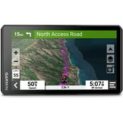
- High-resolution satellite imagery with direct-to-device downloads.
- Multi-GNSS satellite support with ABC sensors for versatile navigation.
- Exceptional battery life: up to 24 hours in GPS mode and 432 hours in expedition mode.
- Meets rigorous MIL-STD 810 and IPX7 ratings for durability and water-resistance.
Ubuy Assurance
Experience worry-free shopping with 100% original products, PCI DSS-compliant payment security, ISO 27001-certified data protection, the fastest cross-border delivery, free returns *, and secure packaging on every order.